Search the SPREP Catalogue

Refine Search Results

Related Countries

Tags / Keywords

Language

Available Online

Related Countries

Tags / Keywords

Available Online

10 result(s) found.

Sort by

You searched for

  • Tags / Keywords country:samoa
    X
  • Tags / Keywords oryctes rhinoceros
    X
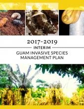
Guam invasive species management plan interim 2017-2019: interim
BRB
Available Online
2017
The 2017-2019 Interim Guam Invasive Species Management Plan (GISMP) expresses the overarching goals and priorities of the Guam Invasive Species Council (GISC or Council). The Guam Invasive Species Act of 2011 (Public Law 31-43) established the Council as Guam’s lead entity in coordinating with local, regional, national, and international jurisdic¬tions in the fight against alien invasive species. Although the GISC is in its infancy stages of organization, it draws from the collective knowledge, past research, and progress of its members in establishing the Council’s goals and priorities. Priorities and goals identified in this plan reflect current and near-term resources, member capabilities, and status of certain invasive species. Recommendations contained in the Regional Biosecurity Plan for Micronesia and Hawaii (RBP), the 2016-2018 National Inva¬sive Species Council’s Management Plan, the Regional Invasive Species Council (RISC), and various stakeholders were considered in the development of this plan. The Council also considered developments under the purview of the Hawaii Invasive Species Council and its 2015-2020 HISC Strategic Plan.
Samoa Tsunami rapid environmental impact assessment report: draft October 14th 2009
Island and Ocean Ecosystems
Available Online

Ifopo, Pulea Etiseli

2009
A rapid assessment of the environmental impacts of the 29 September tsunami was conducted by a multi-agency team from 3 to 14 October, 2009. Fourteen “green” and 10 “brown” environmental variables were selected and measured based on the experience of the survey team and similar reports from elsewhere. During a tour of the affected area on Upolu by car and on foot those “assessable” variables were scored “high” (over two thirds affected), “medium” (over one third, less than two thirds affected), “low” (less than a third affected) or zero (unaffected). Manono and Savaii were surveyed by air with the former showing evidence of some damage and the later apparently none or very little. The most affected areas in Upolu were villages in the Aleipata, Lepa and Falealili districts with the most obvious indicators of the tsunami’s impact being solid waste (sometimes resulting from the complete destruction of a village), erosion of the beach and fore-shore and the (expected) impact on marine resources. Other environmental variables assessed also showed similar patterns. Impacts on a wharf/dry dock facility are also described (including lost fuel drums) as are the possible environmental implications of new settlements created by displaced persons (mainly revolving around sanitation, drainage and water supply).